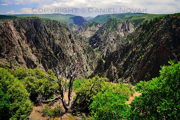
This is one of the initial views one gets when visiting the Black Canyon of the Gunnison National Park from the south. It's quite an appetizer! A deep canyon way down with a great mix of rocks and greenery. And a long canyon going as far as eyes can see. It always amazes me what rivers can do over time. And not only does nature provide a great appetizer, it keeps up with the quality all throughout the canyon.
This National Park does not have the fame of the Grand Canyon neither its size but it offers something else, a feeling of intimacy, a feeling of the magnificence right at your fingertips
The Black Canyon of the Gunnison is located in western Colorado.
Canyon. The whole canyon is 48 miles long. 12 miles of the canyon are located within the national park, including the deepest and most dramatic part. The Gunnison River drops 34 feet per mile, the fifth steepest mountain descend in North America. The Colorado River drops about five times slower through the Grand Canyon. It is also the steepness, deepness, and narrowness that gives the canyon its name since the light struggles finding the way down between the canyon walls often leaving them in the dark, or black.
The Gunnison River is formed by the confluence of Taylor and East rivers at Almont in eastern Gunnison County. Just past the town of Gunnison and is the 5th largest tributary to the Colorado River in Grand Junction, Colorado.
After seeing the impassable terrain the Gunnison RIver created and flows through, it is hard to believe there once was a narrow gauge railroad passing along. It must have been quite a scenic ride. Look for Denver and Rio Grande Narrow Gauge Railroad.
Sources:
-
Black Canyon of the Gunnison National Park on Wikipedia
-
Gunnison River on Wikipedia
-
Narrow Gauge Railroad Through Black Canyon on nps.gov