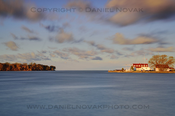
This is where the mighty Niagara River ends at its mouth into Lake Ontario. This was a wonderful fall morning. The sun has just cleared the horizon and lit up the river and its shores. It was still low enough to add some color into the clouds floating overhead.
The building complex on the right is the US Coast Guard Station, established in 1893 just below the Old Fort Niagara. Its mission is Search and Rescue, Maritime Law Enforcement, Homeland Security, Ice Rescue, Recreational Boating Safety, Drug and Alien Migrant Interdiction, Military Readiness and Environmental Response.
The Niagara River flows out of the north-eastern corner of Lake Erie into a roughly south-western corner of Lake Ontario. It forms an international border between the United States and Canada. Along its course, the river travels 35 miles and loses 325 feet in elevation, approximately half of that at Niagara Falls. Since the ships of Great Lakes and Saint Lawrence Seaway would have a rather hard time at the Falls they use the Welland Canal on the Canadian side.
Despite its beauty and might the river did not avoid environmental issues. For a long time, economic factors were the sole driving forces and the industries along the river banks contributed to quite a pollution. That has been improving in recent years and the levels of bacteria and toxic substances have been decreasing.
The river is bridged by several major bridges, including the Peace Bridge, South Grand Island Bridge, North Grand Island Bridge, Rainbow Bridge, and Queenston-Lewiston Bridge. See my
Bridges of Buffalo to see many of them.
References:
Fort Niagara State Park on Wikipedia -
Coast Guard Station Niagara