
- Home
- | Galleries ▼
- | Collections ▼
- | About ▼
- | Blog
- | Zines
- | Login
Road Trip: The Forgotten Grand Mesa Day

Colorado became the 38th state to join the United States on August 1, 1876. The capital city is Denver. The highest point is Mt. Elbert at 14,433 feet.
Road Trip 2013 - Day 9 - June 19 - Grand Mesa (Previous 2013 Road Trip posts: Indiana Dunes, De Immigrant, Amana Colonies, Des Moines, Madison County Roads, Bridges of Madison County, White Pole Road, Great Platte River Road Archway Monument, Golden Spike Tower & Union Pacific's Bailey Rail Yard, Loveland Pass, The Resting Day at Powderhorn, Black Canyon of the Gunnison, Cimarron, Colorado National Monument, Fruita Rodeo, You are here!, Arches National Park, Grand Junction, Grand Mesa Creek, Arches National Park Add-On, Canyonlands National Park, The Little Big Moments of Road Tripping, Mesa Verde National Park, Santa Fe)
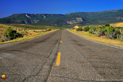 Heading for the Grand MesaLands End Road Experience
 As I kept building on the Road Trip 2013 story line and tried to keep the photos in my galleries in sync with the blog I noticed something was off. The numbered days no longer tied to the dates in June. It took me a while but I found the problem. I guess I was eager to re-live my Arches National Park experience and get to that post, skipping a fun day on the Grand Mesa.
Our Colorado base for the week was on the slope of the Grand Mesa not far from Mesa, Colorado. As such it was almost a must not to miss an opportunity to explore that mountain. The Grand Mesa is the largest flat-topped mountain in the world with an area of about 500 square miles and stretches between the Colorado and Gunnison Rivers (yes, the one that created the Black Canyon of the Gunnison). It rises to about 11,000 feet, a whole 6,000 feet above the surrounding valleys! And yes, it is flat on top. From a distance it looks like someone simply cut the top half of the mountain off. Fortunately, that is not the case like with many mountains in the Appalachia where coal mining companies did just that! (Listen to John Grisham's Gray Mountain: A Novel
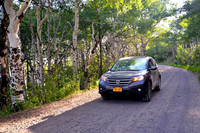 Aspen Forest on Lands End RoadLands End Road Experience
The highlight of the whole exploration certainly was the Lands End Road (aka, F S Rd). From Rte 50 it took us a little bit of map study to find its beginning but we quickly realized we missed our turn, turned around, and then turned right onto Kannah Creek Road, which quickly took us to the Lands End Road. The views were splendid right away, as it so often happens when one leaves the expressway. The mountain was right in front of us with the road disappearing somewhere at its base. If we needed any more encouragement this was it, and it just got better and better as we followed the pavement to a dirt road up the mountain side. Yes, the pavement disappeared turning into a gravel road that was getting narrower and narrower.
Aspen Forest on Lands End RoadLands End Road Experience
The highlight of the whole exploration certainly was the Lands End Road (aka, F S Rd). From Rte 50 it took us a little bit of map study to find its beginning but we quickly realized we missed our turn, turned around, and then turned right onto Kannah Creek Road, which quickly took us to the Lands End Road. The views were splendid right away, as it so often happens when one leaves the expressway. The mountain was right in front of us with the road disappearing somewhere at its base. If we needed any more encouragement this was it, and it just got better and better as we followed the pavement to a dirt road up the mountain side. Yes, the pavement disappeared turning into a gravel road that was getting narrower and narrower.
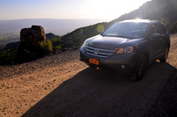 Drop Off on Lands End RoadLands End Road Experience
Then it became an essentially single lane road climbing up switchbacks with seemingly no room to either side. A cliff up on one side, a drop-off to the other. I felt bummed out not to take any photos during those few miles but I did not feel like getting out of the car. I opened the door once and contemplated just that but decided the foot or so of space was not a good idea that day. I am pretty sure that people that use the road more often would have no problems doing that but I chickened out.
Drop Off on Lands End RoadLands End Road Experience
Then it became an essentially single lane road climbing up switchbacks with seemingly no room to either side. A cliff up on one side, a drop-off to the other. I felt bummed out not to take any photos during those few miles but I did not feel like getting out of the car. I opened the door once and contemplated just that but decided the foot or so of space was not a good idea that day. I am pretty sure that people that use the road more often would have no problems doing that but I chickened out.
I did get a few photos as soon as the road widened. First, we passed through a beautiful aspen forest and later a beautiful view down into the valley opened up. In both occasions I felt like shooting a Honda commercial and including our CR-V in the scene. There was also one nice turn where the Lands End Road was visible behind us winding through the landscape.
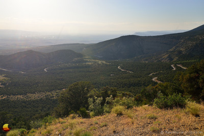 Lands End Road Winding Up the Grand MesaLands End Road Experience
It was straight against the sun but I liked it for this photo. While it did not allow me to balance the brightness of the sky with the land below it added mood to this rugged scene, a fairly dry mountain slope with a dirt road heading up the hill. Can you feel the sun's heat?
Once we made it all the way up we pulled into the Grand Mesa National Forest Visitor Information Center. Not for the center itself, as it was closed at that late time of the day, but for the views back to where we just came from. One thing I was not able to capture in the last photograph of this post was the wind. Wow, was it windy! Windy and rather chilly! The late evening, the elevation, and the wind completely transformed the heat of the valley below into a whole different experience.
From here, we still had quite a bit of the Lands End Road ahead of us. It was all level though and winding through some beautiful areas of the Grand Mesa that would certainly deserve more than driving through. Picturesque lakes with hiking trails and fishing, wildlife, just beautiful every step of the way.
By the time we made it back to our base it was pitch black, so typical for our returns to the base. And so the Grand Mesa adventure ended and now this series of posts from 2013 no longer has a big hole in it.
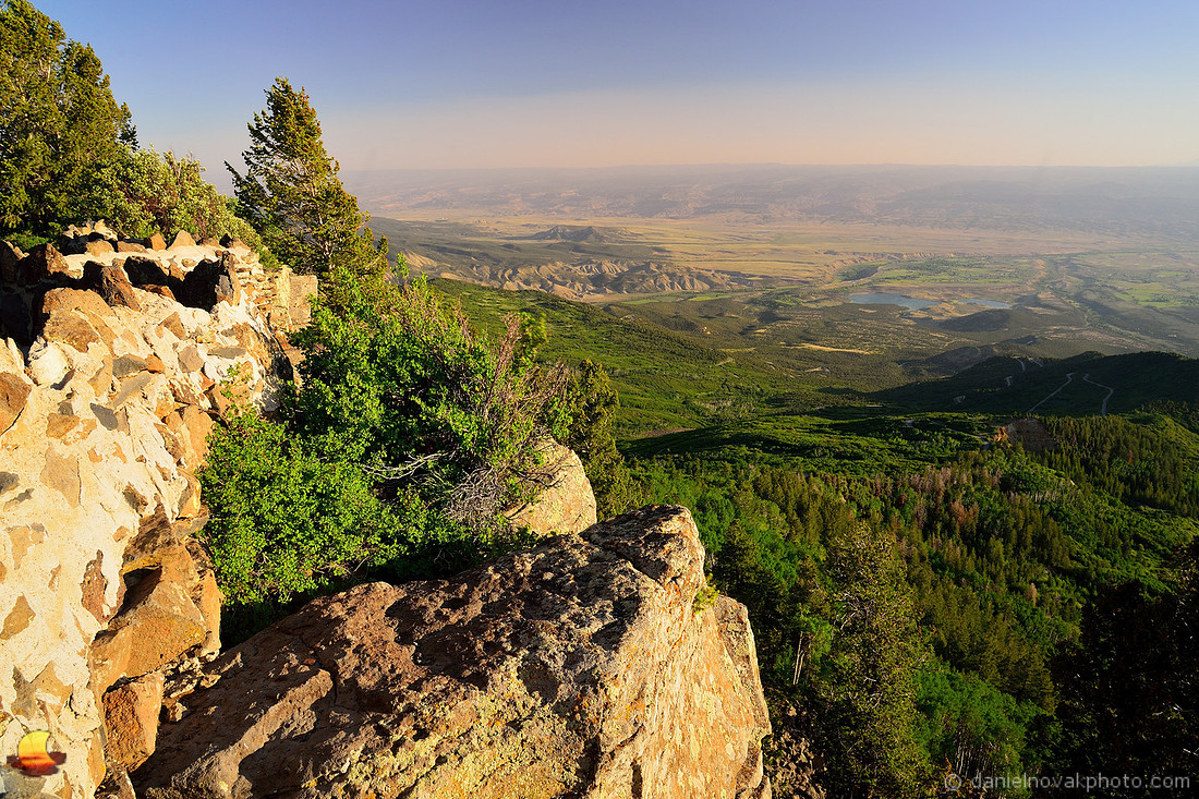 Top of the World on Lands End RoadLands End Road Experience
Top of the World on Lands End Road, Colorado
Top of the World on Lands End RoadLands End Road Experience
Top of the World on Lands End Road, Colorado
Enjoy the beauty that surrounds you! (#etbtsy)
References: Grand Mesa on Wikipedia - Lands End Observatory on Wikipedia - Gray Mountain: A Novel
If you've enjoyed this post and would like to see more of my photographs, feel free to visit my photo galleries to see more from Buffalo, Western New York, and well beyond! Do you enjoy photographs featuring roads, paved and unpaved? Then the On the Road Collection might be for you. Please, let me know if you have any questions about any photo products offered, or not offered. I also offer ready to hang solutions like canvas gallery wraps, or matted and framed photographs. Those options are available using the "Frame It" link once you place a photo in your shopping cart.
Using my links to do your shopping keeps me sharing more photographs and writing the stories behind them and costs you nothing. You can also use the Amazon search box in bottom left for anything not mentioned here. I truly appreciate each purchase, no matter how small or large. Thank you!